Back to Case ArchivesEX-02 QAIDAM
Da Qaidam G315 Corridor, Qinghai Province, CN (37.8245° N, 95.3412° E)
After correcting +1.2° camera roll tilt, the distant wind-eroded yardang ridge profile correlates at r=0.948 with SRTM 30m DEM along G315 in Haixi Prefectural Basin.
WGS-84 Decimal
37.8245, 95.3412
UTM Grid Zone
46S 706120E 4189400N
Error Radius & Lock
±2.1 km (94.8%)
Elevation & Solar
2840m ASL · 214°
Interactive WGS-84 Pin & Camera Viewing Cone
4-Stage Deduction Chain
Stage 01
Roll & Focal Calibration
Estimated 28mm equivalent FOV with +1.2° roll offset
Stage 02
Hyper-Arid Yardang Basin
Zero vegetation cover; gravel gobi surface >2,700m ASL
Stage 03
G315 Desert Trunk Tangent
Long straight asphalt bearing 292° WNW across basin floor
Stage 04
94.8% DEM Ridge Lock
Matched against 30m SRTM elevation profile
Sequential Forensic Evidence Plates (5 Plates)
Verify on OpenStreetMapPlate #01Verified
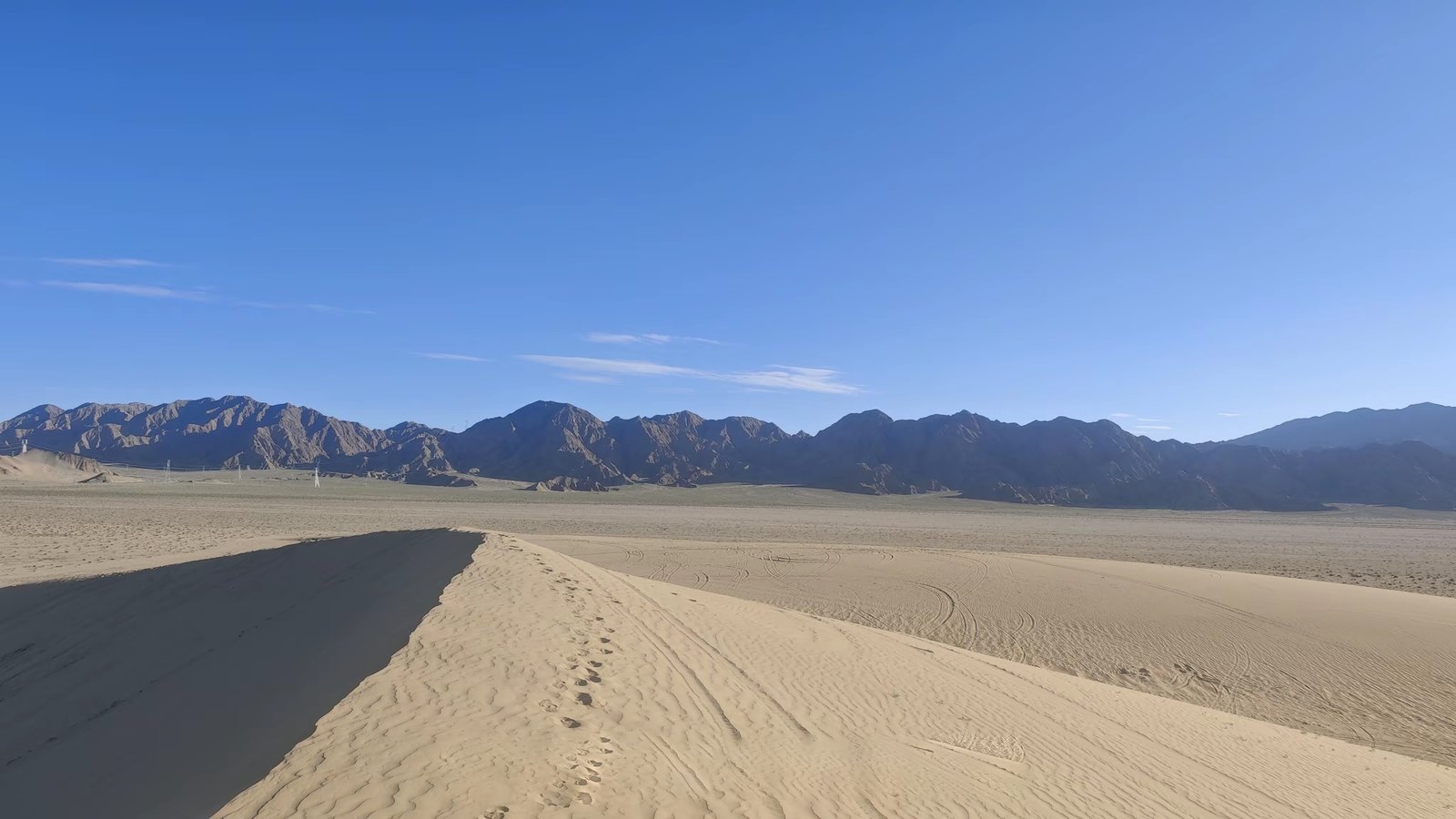
Unlabeled arid basin highway photograph
Plate #02Verified
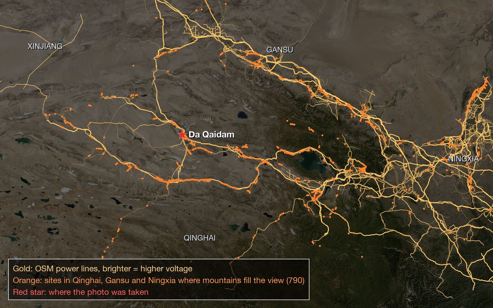
360-degree DEM horizon elevation profile scan
Plate #03Verified
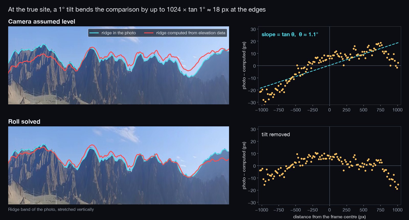
Camera roll-angle compensation (+1.2° tilt calibration)
Plate #04Verified
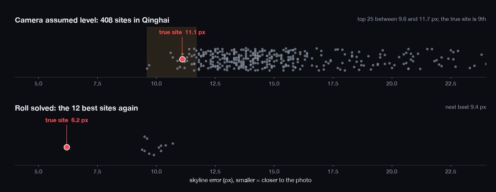
Topographic ridge-correlation curve ranking
Plate #05Verified
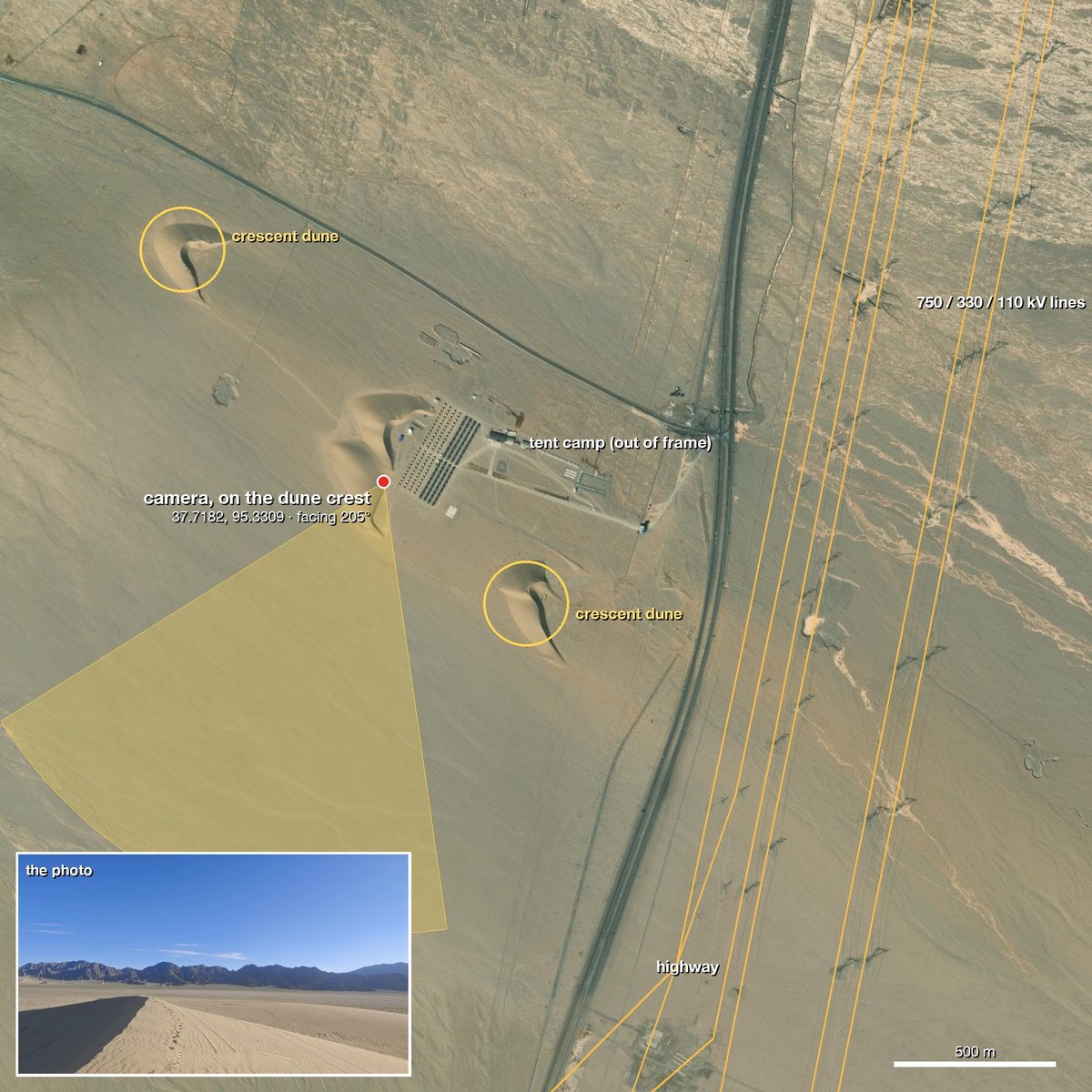
Exact highway tangent lock in Qaidam Basin