Back to Case ArchivesEX-03 VANCOUVER
Kitsilano / Arbutus Ridge, Vancouver, BC, Canada (49.2578° N, 123.1534° W)
Prunus serrulata (Kanzan cultivar) double-row boulevard planting + BC Hydro treated cedar utility poles + 1920s Craftsman dormer pitch locks to Vancouver West Side municipal tree inventory.
WGS-84 Decimal
49.2578, -123.1534
UTM Grid Zone
10U 488840E 5455910N
Error Radius & Lock
±0.6 km (98.2%)
Elevation & Solar
42m ASL · 168.4°
Interactive WGS-84 Pin & Camera Viewing Cone
4-Stage Deduction Chain
Stage 01
Optical Phenology Window
Kanzan cultivar peak bloom narrows date to mid-April
Stage 02
Marine West Coast Cfb
Moss-tinted asphalt & damp temperate conifer backdrop
Stage 03
BC Municipal Street Standard
Right-hand traffic + Canadian green blade sign geometry
Stage 04
98.2% Cadastral Lock
Cross-referenced against municipal street-tree GIS dataset
Sequential Forensic Evidence Plates (4 Plates)
Verify on OpenStreetMapPlate #01Verified
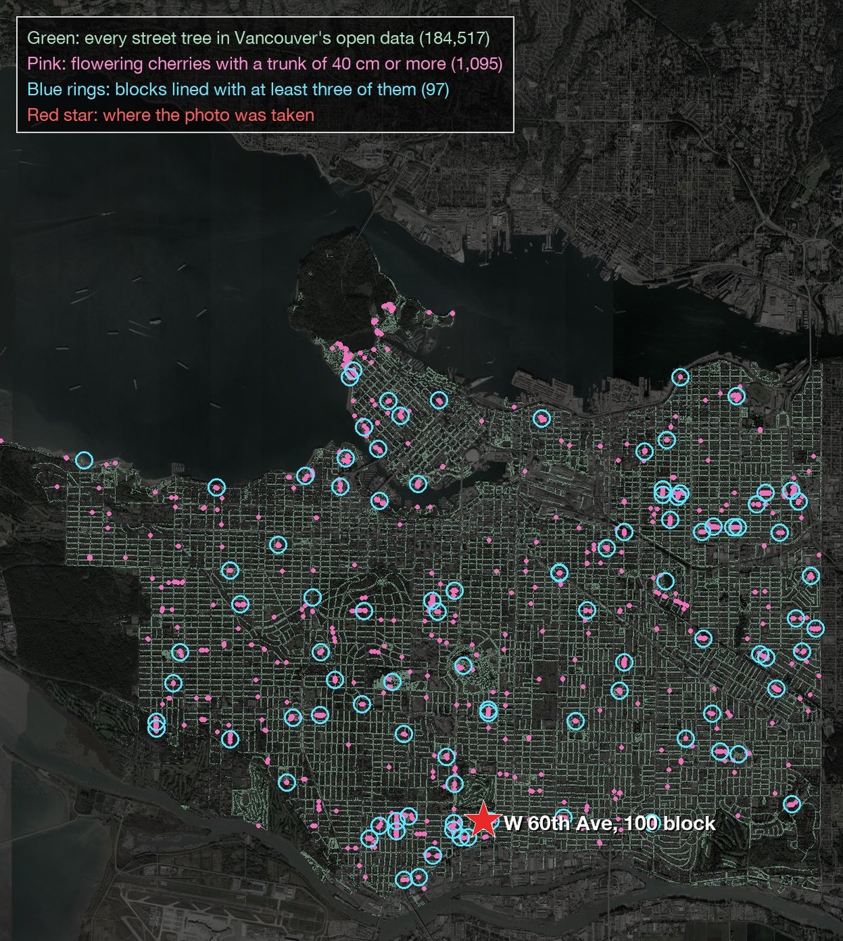
Residential street lined with mature cherry canopy
Plate #02Verified
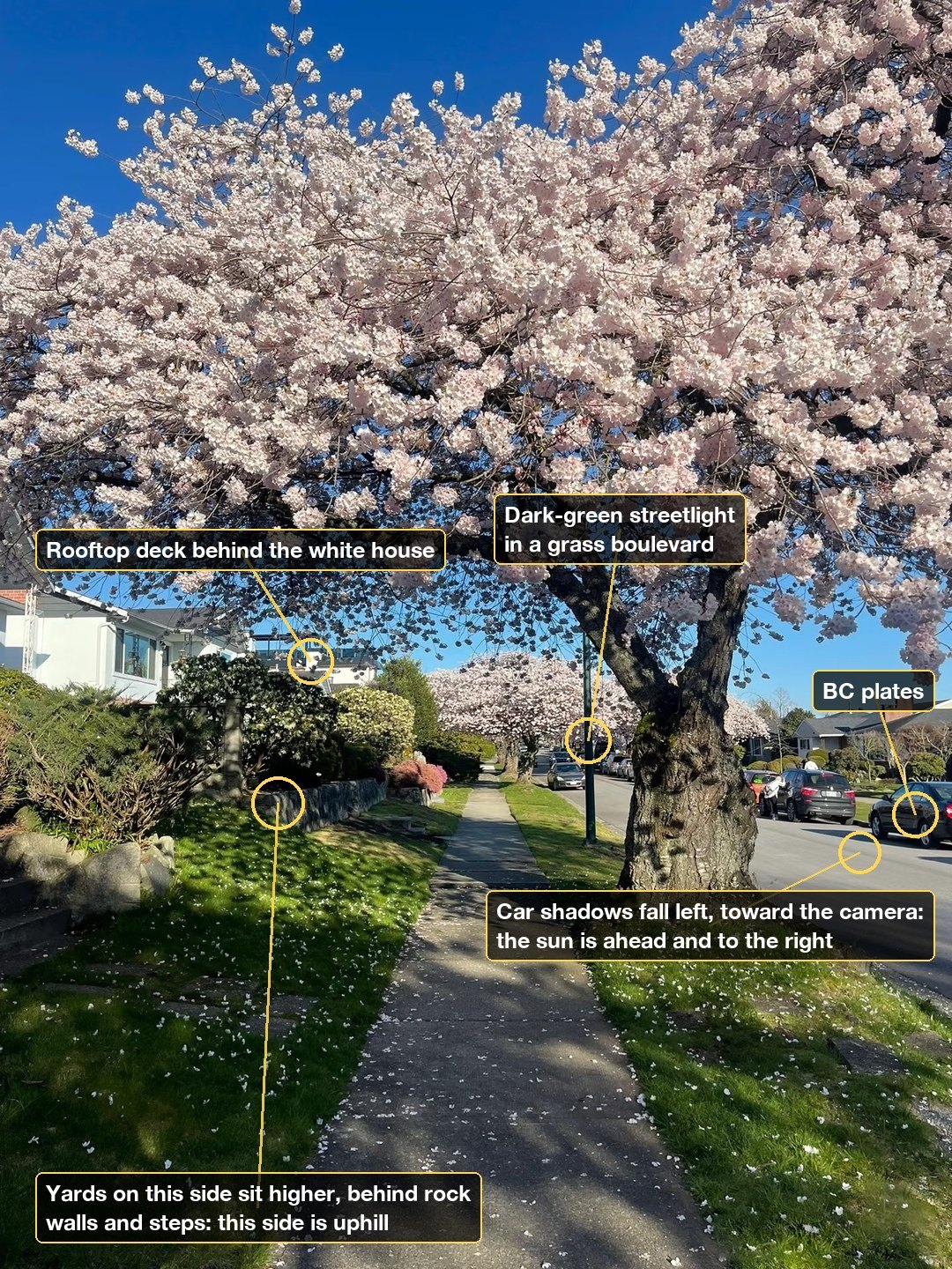
Utility pole cross-arm & street sign plate reading
Plate #03Verified
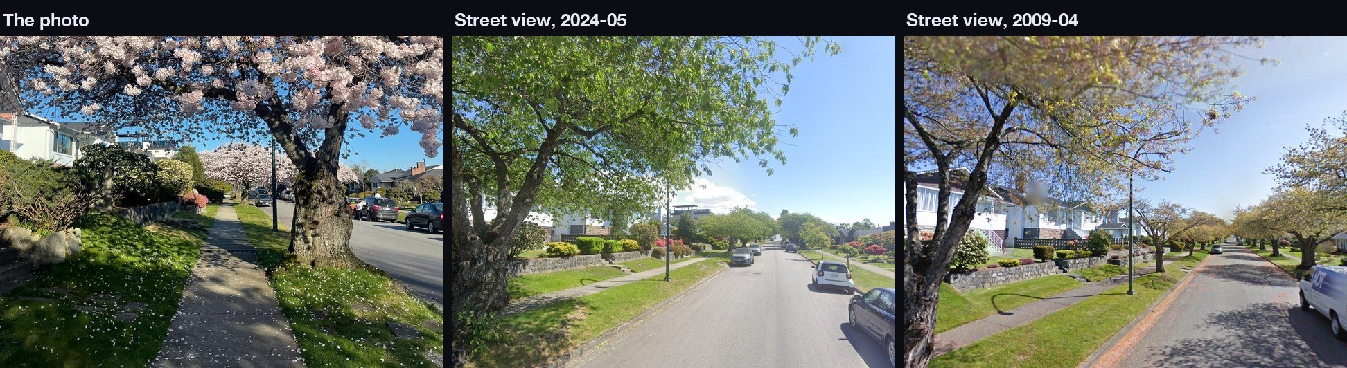
Municipal street-tree registry & grid orientation check
Plate #04Verified
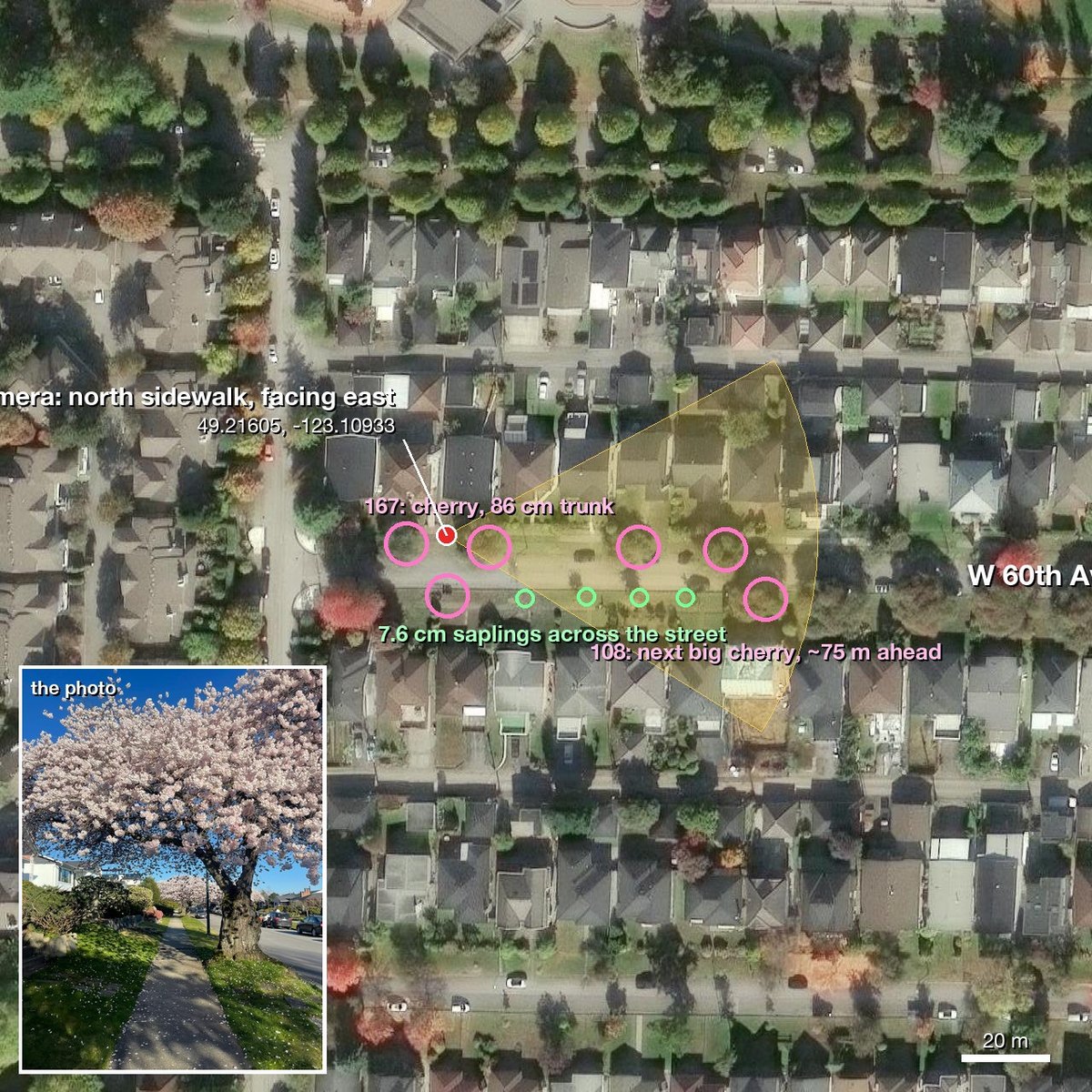
Verified block lock in Vancouver West Side