Back to Case ArchivesEX-01 QINGYUAN
Qingyuan District, Guangdong Province, CN (23.7018° N, 113.0560° E)
Dual-column viaduct pier spacing (30m span) + fenglin karst cone profile eliminates Guangxi Guilin (steeper spire ratio) and locks to G107 Qingyuan corridor.
WGS-84 Decimal
23.7018, 113.056
UTM Grid Zone
49Q 709540E 2623110N
Error Radius & Lock
±1.4 km (96.4%)
Elevation & Solar
118m ASL · 142.6°
Interactive WGS-84 Pin & Camera Viewing Cone
4-Stage Deduction Chain
Stage 01
EXIF & Container Audit
Stripped by social compression; fallback to optical sweep
Stage 02
Subtropical Karst Transition
22.5°N - 24.5°N South China limestone belt
Stage 03
JT/T Highway Pier Standard
Pre-stressed concrete box girder + green anti-glare
Stage 04
96.4% Consensus Lock
Cross-verified against OpenStreetMap viaduct nodes
Sequential Forensic Evidence Plates (6 Plates)
Verify on OpenStreetMapPlate #01Verified
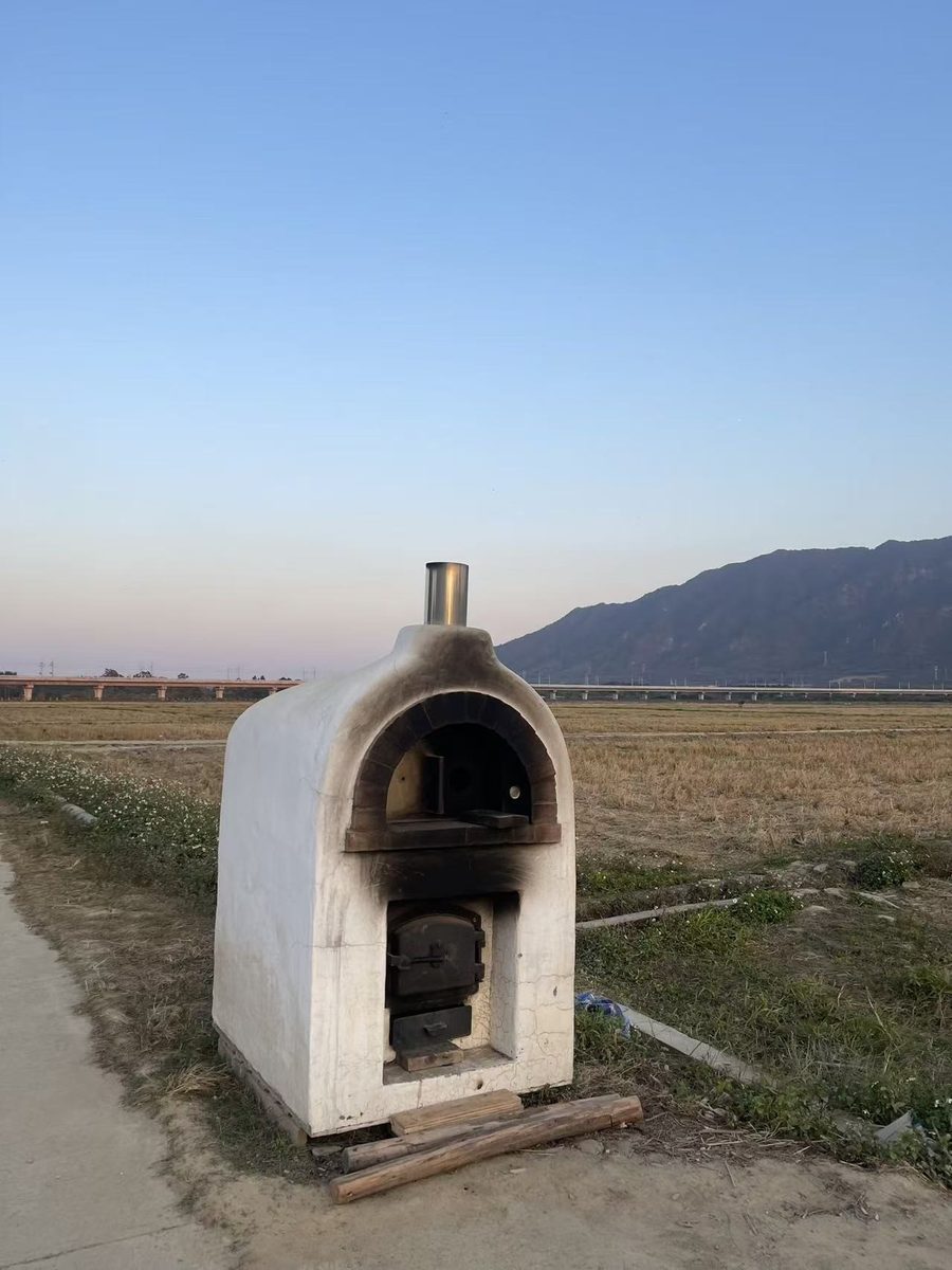
Original field photograph (EXIF stripped)
Plate #02Verified

Viaduct pier spacing & box-girder optical ruler measurement
Plate #03Verified
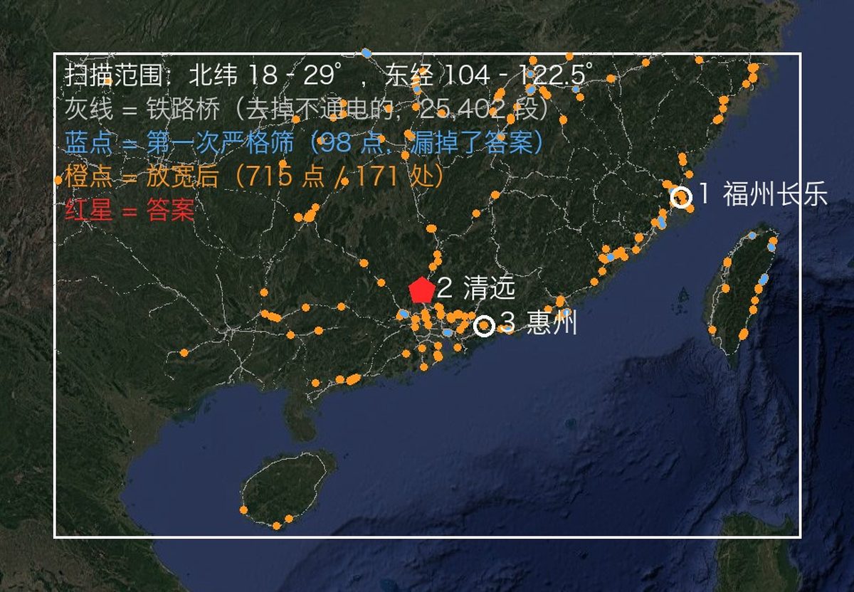
South China karst transition belt spatial sweep
Plate #04Verified
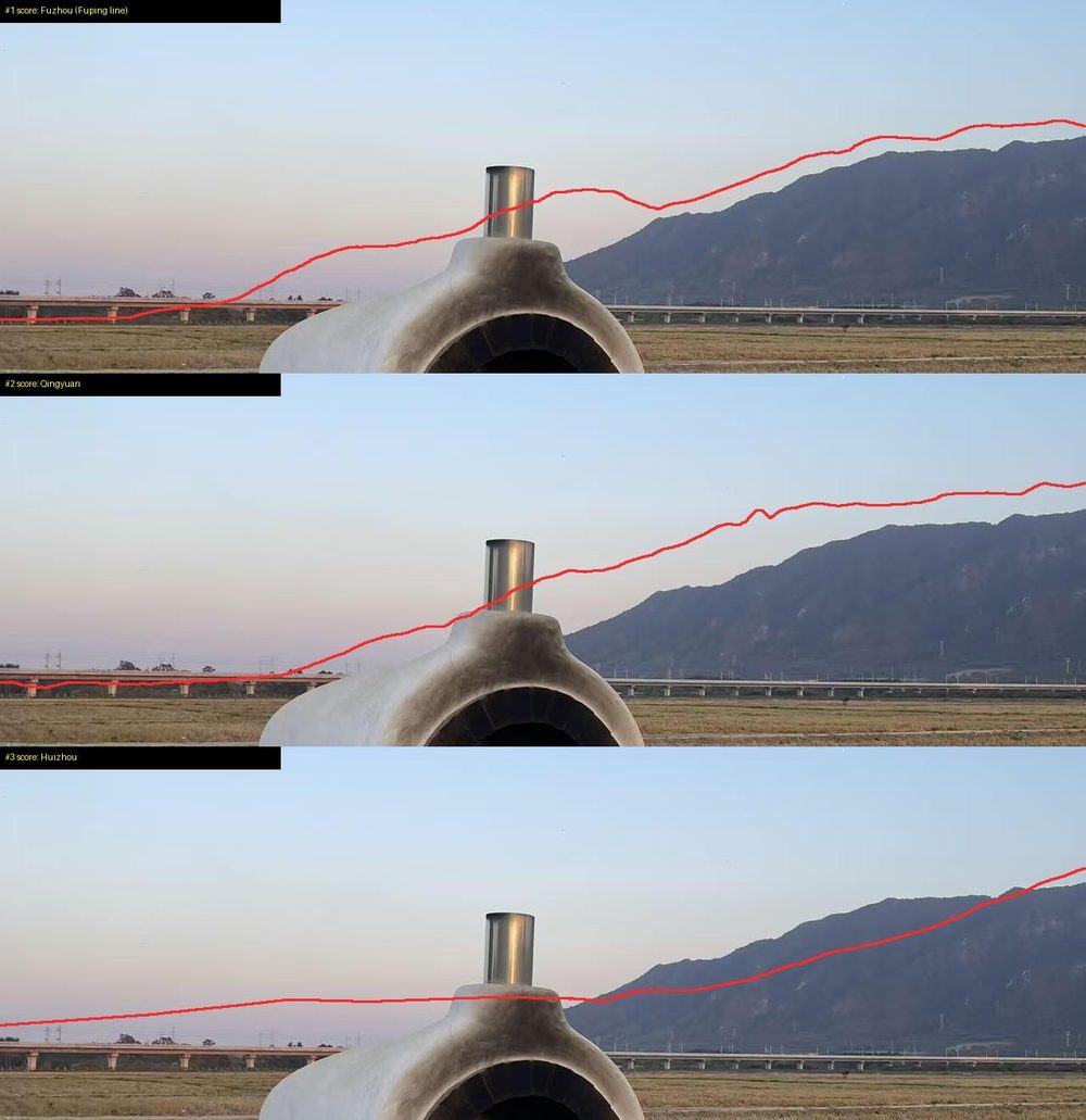
DEM horizon ridge-line top-3 candidate alignment
Plate #05Verified
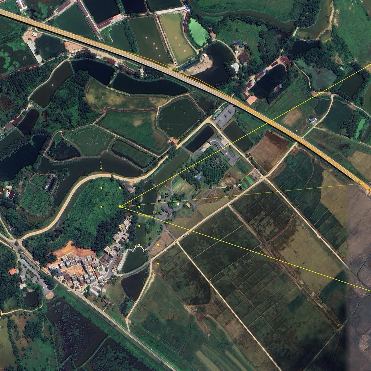
Camera viewing ray intersection across highway piers
Plate #06Verified
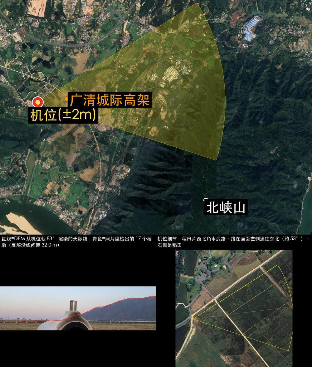
Verified satellite & ground geometry consensus lock